

![English [GB]](../../../language/en_GB/en_GB.jpg "English [GB]")
![English [US]](../../../language/en_US/en_US.jpg "English [US]")
![Nederlands [NL]](../../../language/nl_NL/nl_NL.jpg "Nederlands [NL]")
)
)
)
)
)
)
)
)
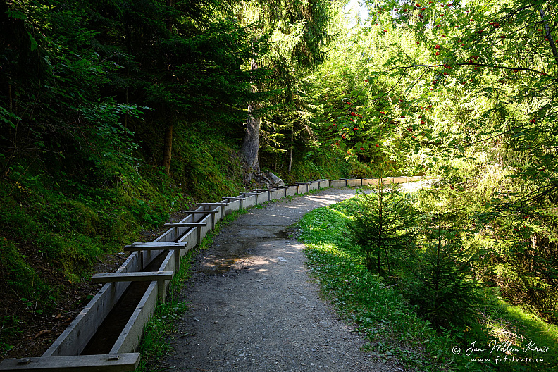
Bisse Vieux Irrigation Channel
Camera brand and type used to take photo
 Model unknown
Lens used
Model unknown
Lens used
 Lens info unknown
Model unknown
Lens used
Lens info unknown
Aperture used
 Unknown aperture
Exposure used
Unknown aperture
Exposure used
 Unknown exposure time
Exposure compensation applied
Unknown exposure time
Exposure compensation applied
 Unknown exposure compensation
ISO used
Unknown exposure compensation
ISO used
 Unknown ISO
Unknown aperture
Exposure used
Unknown exposure time
Exposure compensation applied
Unknown exposure compensation
ISO used
Unknown ISO
Photo Info
fgk-20260817-20250825-no metadata-Z9-3606a-bisse-vieux-nendaz-historic-irrigation-channel.jpg
2560*1707
(1829 KB)
10x visited
Description
Headline
Bisse Vieux Irrigation Channel
Caption
The Bisse Vieux is a historic irrigation channel in Nendaz. Its exact construction date is unknown, but a municipal document dated 1658 shows that the channel was already in existence by then.
About seven kilometres long, it takes water from the Printse between Siviez and Planchouet and still contributes to irrigation around Haute-Nendaz, Fey and Bieudron.
The route also illustrates how bisses evolved technically: original wooden troughs were replaced in some sections by concrete pipes, metal channels and other structures where terrain, erosion or avalanche exposure demanded a more durable solution.
About seven kilometres long, it takes water from the Printse between Siviez and Planchouet and still contributes to irrigation around Haute-Nendaz, Fey and Bieudron.
The route also illustrates how bisses evolved technically: original wooden troughs were replaced in some sections by concrete pipes, metal channels and other structures where terrain, erosion or avalanche exposure demanded a more durable solution.
Image Alt text
Forest path running beside an open historic irrigation channel with timber supports and a narrow water trough.
Event
-
Keywords
Capture info
(IPTC Instructions)
(IPTC Instructions)
Metadata generated by ChatGPT GPT-5.6 Sol at 17-Aug-'26 21:30 with AI Photo Metadata Grabber ChatGPT v1.23.25 (83% confidence). Possible Location Created identified (82% confidence). Location Shown estimated (82% confidence). Possible GPS position identif
Location
Location
- - - -
Altitude
1400 meter
Properties
Original filename
20250825-no metadata-Z9-3606a.jpg
Taken on
-
Scanned on
### No CreateDate ###
Digital Source
Unknown
Posted first on
17-Aug-2026 21:34:58
Update posted on
17-Aug-2026 21:34:59
Rating/label
Adobe Lightroom
Adobe Lightroom
Label and rating as set in Adobe Lightroom
Rating score
no rating
Update rating
Rate this photo
Copyright
Credit line
-
Copyright
-
Copyright Notice
-
Photographer
Jan-Willem Kruse
Other Info
Related albums
Job identifier
-
0 comments